

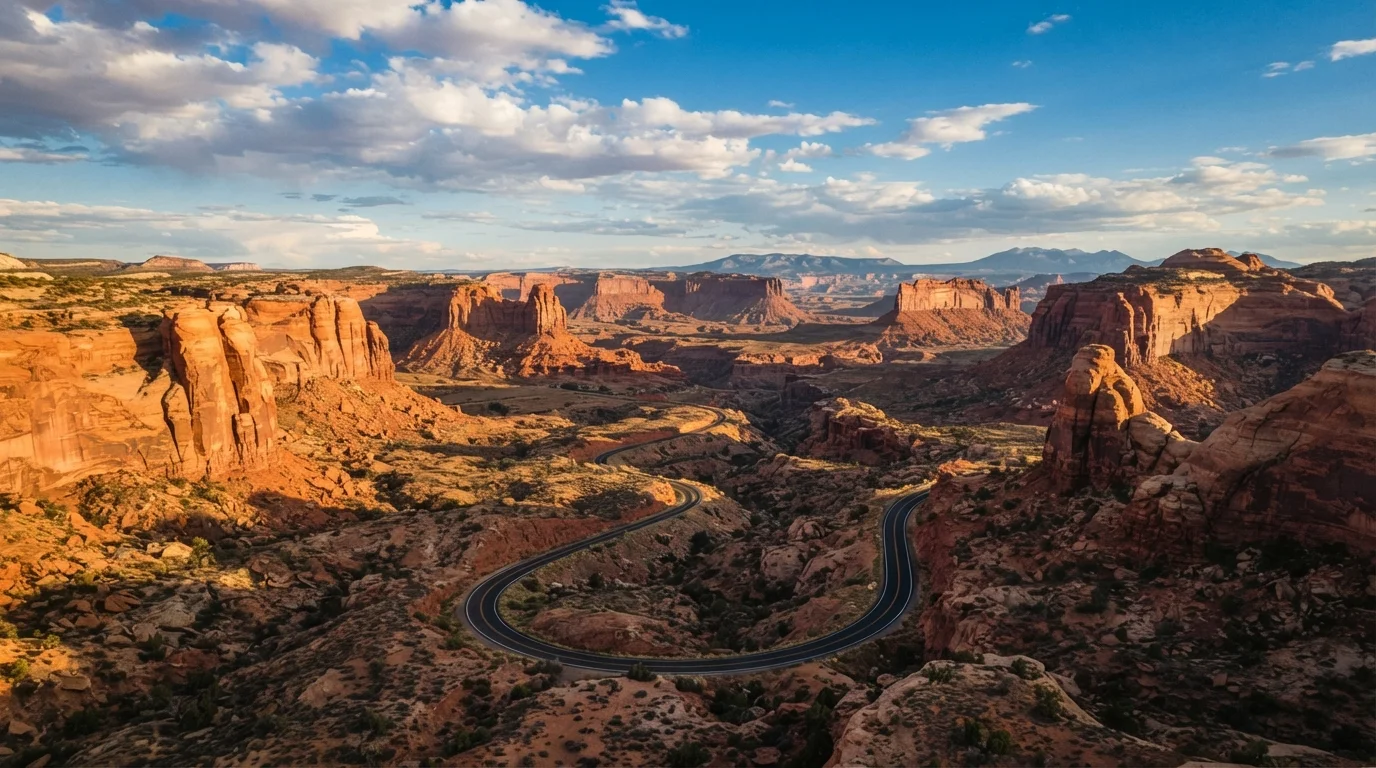
Why the Southwest Is Built for Road Trips
Few regions in the United States reward a road trip the way the American Southwest does. The distances between landmarks are part of the experience — not an inconvenience. Wide-open highways carry you from one geological wonder to the next, and the transitions feel cinematic: red sandstone gives way to piñon-juniper forest, then drops into a river canyon, then opens onto a salt flat under an enormous sky.
Utah, Arizona, and New Mexico together hold an extraordinary concentration of public land, including national parks, national monuments, and Bureau of Land Management (BLM) areas that are freely accessible to the public. This means that even travelers on modest budgets have access to world-class scenery — no resort fee required. If you're curious how this region stacks up against other legendary American drives, see our guide to America's classic road trip routes for a broader comparison.
Core Corridors to Know
The Southwest has several well-worn road trip spines worth understanding before you plan your route.
Utah's Mighty Five Loop
Five national parks — Zion, Bryce Canyon, Capitol Reef, Canyonlands, and Arches — sit within a relatively compact region of southern Utah, making a loop drive practical in five to seven days. Highway 12, connecting Bryce Canyon and Capitol Reef, is consistently rated among the most scenic roads in the country. The national parks along US road trip corridors are worth researching before you finalize your itinerary.
Arizona's Grand Circle
From Flagstaff, drivers can reach the Grand Canyon's South Rim in about 90 minutes. Extend south to Sedona's red rock formations, east along the Mogollon Rim, or north through Monument Valley and into the Utah canyon country. US-89 and US-160 are the practical connectors across this stretch.
New Mexico's High Desert Route
US-550 and US-64 carry travelers through the Navajo Nation, past Chaco Culture National Historical Park, and eventually into Taos and Santa Fe. This corridor is less trafficked than Utah's parks, which means fewer crowds and a more solitary feel — an excellent option for those drawn to cultural and archaeological history.
Book Zion and Arches campground sites the moment reservation windows open on Recreation.gov — often six months out. These two parks fill faster than almost anywhere else in the country.
Both parks have strict access limits and high demand during spring and fall peak seasons; late-booking travelers regularly find nothing available within 50 miles.
Drive Highway 12 in Utah from east to west (Capitol Reef toward Bryce Canyon) so the most dramatic overlooks — particularly along Hogsback Ridge — are on the driver's side.
Direction of travel significantly affects what you can safely observe from behind the wheel; the western approach puts the most jaw-dropping drops in your line of sight.
When to Go: Seasons and Desert Realities
Desert weather is not forgiving at the extremes. Midsummer temperatures in low-elevation areas like the Grand Canyon's inner gorge or Moab regularly exceed 100°F, making strenuous hiking genuinely dangerous and long drives physically exhausting without strong air conditioning.
Spring (March–May) and fall (September–November) offer the most comfortable driving conditions — mild days, cool nights, and wildflowers in higher elevations during spring. These shoulder seasons also see lighter crowds at major parks, though spring break weeks in March are a notable exception.
Winter is viable for lower-elevation sites like Saguaro National Park near Tucson, but higher areas in Utah and northern Arizona can see snow and road closures. Summer is manageable if you prioritize early-morning activity and understand the heat risk.
Monsoon season runs roughly from mid-June through September across much of Arizona and New Mexico. Afternoon thunderstorms can cause flash floods — particularly dangerous in slot canyons — with very little warning. Always check weather and ranger alerts before entering canyon areas during this period. Our article on timing seasonal drives across US regions covers this in more depth.
Preparing Your Car for Desert Driving
A desert road trip is hard on vehicles in ways that a temperate coastal drive is not. Heat stresses cooling systems, tires, and fluids significantly. Have a qualified mechanic check the following before you leave:
- Coolant and radiator condition — overheating is a common breakdown cause in the desert.
- Tire pressure and tread — hot pavement increases blowout risk; check pressure in the cool morning, not after driving.
- Engine oil, transmission fluid, and belts — heat accelerates wear on all of these.
- Air conditioning function — in summer heat this is a safety system, not a luxury.
Also carry a physical spare tire in good condition, a jack, and jumper cables. Cell service is genuinely sparse across large stretches of New Mexico and Utah, so roadside assistance apps may not be reachable when you need them most.
Flash Flood Risk Is Real and Fast-Moving
Slot canyons in Utah and Arizona — including famous spots like Antelope Canyon and The Narrows in Zion — can flood violently from storms miles away with no rain visible at the canyon entrance. Always check the National Weather Service flash flood outlook and consult with park rangers before entering any slot canyon, especially during monsoon season.
Essential Packing and Safety Habits
Hydration is the central concern. Plan for at least one gallon of water per person per day, and carry several gallons extra in the vehicle at all times — not just your hiking supply. Gas stations can be 80 or more miles apart on some routes through the Navajo Nation and rural New Mexico; keeping your tank above half-full is a simple habit that prevents serious problems.
Download offline maps before leaving populated areas. Both Google Maps and apps like Gaia GPS allow offline downloads, and the latter is especially useful for navigating dirt roads to BLM camping sites. A printed paper map of each state is genuinely useful as a backup.
Inform someone of your itinerary if you plan to explore remote areas, particularly if you're traveling solo. For more on that, see our practical guide to solo road tripping in America.
Sun protection — hats, sunscreen, UV-blocking windows — matters more than most first-time desert visitors expect. UV intensity at high desert elevation (Taos sits above 7,000 feet) is substantially higher than at sea level.
Lodging Strategy: Towns, Camping, and In-Between
The Southwest offers a genuine spectrum of lodging, from established campgrounds inside national parks to free dispersed camping on BLM land to small-town motels and boutique hotels in gateway cities like Moab, Sedona, Flagstaff, and Santa Fe.
National park campgrounds fill early — often months ahead for peak spring and fall weekends. Book through Recreation.gov as soon as reservations open. If park campgrounds are full, BLM land surrounding many parks (particularly around Moab and Kanab, Utah) allows free dispersed camping with minimal restrictions; check BLM.gov for specific rules in each area.
If hotels are more your style, gateway towns offer a range of options. Flagstaff and Albuquerque tend to have more accessible pricing than Santa Fe or Sedona, which skew toward higher-end accommodations. Those looking to stretch their travel dollars further will find our budget travel tips hub full of practical strategies. And if this is your first long-distance drive, the beginner's guide to planning a long-distance road trip covers the logistics you'll want to sort before you hit the highway.
However you structure it, the Southwest rewards slow travel. Give yourself more days than you think you need, and let the landscape set the pace.
The content on this site is for informational purposes only and is not a substitute for professional advice. Always consult a qualified professional for guidance specific to your situation.